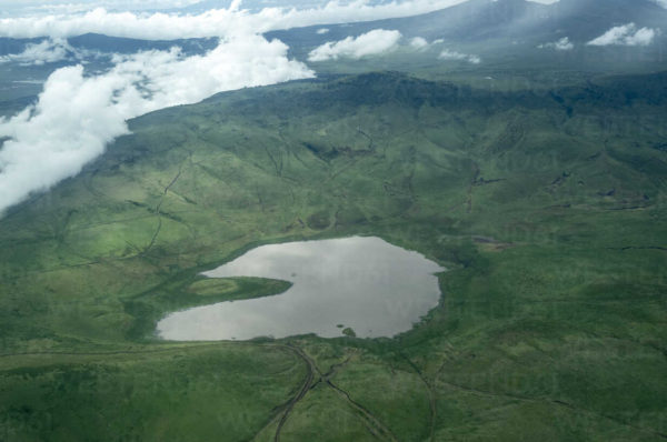
Ngorongoro Conservation Area, national conservation area in the Arusha region of northern Tanzania, southeast of Serengeti National Park. Occupying some 3,200 square miles (8,300 square km), it extends over part of the Eastern (Great) Rift Valley of eastern Africa and contains a variety of habitats and landscapes, including grassland plains, savanna woodlands, forests, mountains, volcanic craters, lakes, rivers, and swampland. Ngorongoro Crater, one of the world’s largest unbroken calderas, is the most prominent feature of the park. Also located there are the major archaeological sites of Olduvai Gorge and Laetolil, within which were found hominin remains dating from 2.1 million and 3.6 million years ago, respectively.
The area’s main volcanic formations, including Ngorongoro Crater and the volcanoes Olmoti and Empakaai, formed from 20 million to 2 million years ago. Empakaai Crater is noted for the deep soda lake that occupies nearly half of its caldera floor.
Ngorongoro Conservation Area is host to the largest ungulate herds in the world, including gnu (wildebeests), plains zebras, and Thomson’s and Grant’s gazelles. Predatory animals include lions, spotted hyenas, leopards, and cheetahs. The endangered black rhinoceros and African hunting dog can also be found there. Notable among more than 400 species of birds in the area are flamingos, silvery-cheeked hornbills, superb starlings, and bronze and tacazze sunbirds.
In 1951 the area was included as part of the original Serengeti National Park, but in 1959 it was separately designated the Ngorongoro Conservation Area. It was added to the UNESCO World Heritage List in 1979. Although cultivation is not permitted within the area, some 25,000 to 40,000 Masai are allowed to graze their livestock there. Issues of concern during the latter part of the 20th century were the damage to the ecosystem caused by overgrazing and tourism vehicles and the diminishing of black rhinoceros, leopard, and elephant populations because of poaching.

